

Is Clifton Safe? Living in Clifton, Bristol (2026 Guide)
Is Clifton, Bristol safe? Yes, very, and the people who live there say so themselves. Many people picture Clifton as Bristol’s grandest neighbourhood, and it’s also where residents feel safest at night. Of 34 Bristol wards, Clifton ward ranks first for feeling safe after dark, and almost everyone feels safe by day (Bristol City Council, 2025).
Worry about crime is rare in Clifton. Just 5.3% of Clifton ward residents say fear of crime affects their daily life, Bristol’s lowest share (Bristol City Council, 2025). Compared with the rest of the city, crime in Clifton leans towards parked cars, not people.
This guide covers both of Clifton’s council wards. For the whole city, read our guide to whether Bristol is safe, which covers nights out.
Key Takeaways
- No Bristol ward feels safer after dark than Clifton ward, where about four in five residents feel safe (Bristol City Council, 2025).
- Compared with Bristol, Clifton ward’s crime leans towards parked cars: vehicle crime is 26% of the total, against 7% citywide (data.police.uk, 2026).
- Recorded crime in Clifton ward runs at less than half Bristol’s rate (data.police.uk, 2026).
- Clifton Down, around Whiteladies Road, feels very safe too: 97.3% of residents feel safe by day (Bristol City Council, 2025).
- Leave nothing on show in your car, and lock your bike’s frame to something fixed.
In this guide
- Is Clifton safe? The short answer
- Clifton or Clifton Down? Two wards, one name
- What crime happens in Clifton?
- How safe does Clifton feel?
- How does Clifton compare with student areas in other cities?
- What is it like to live in Clifton?
- Living in Clifton as a student
- How we worked this out
- Frequently asked questions
Is Clifton safe? The short answer
Among Bristol’s neighbourhoods, Clifton is one of the safest places to live, and residents feel it. Clifton feels safe by day and after dark. In the council’s Quality of Life survey, 81.9% of Clifton ward residents feel safe after dark, Bristol’s highest share (Bristol City Council, 2025). By day, 98.6% of Clifton ward residents feel safe, which is almost everyone.
Recorded crime confirms Clifton’s calm. Measured per resident, Clifton ward’s crime rate is less than half Bristol’s. Clifton ward logged 58.2 crimes per 1,000 residents in the year to August 2026, against 126.8 across Bristol (data.police.uk, 2026). Day to day, Clifton is a calm place to come home to.
Two council wards make up Clifton. Clifton ward covers the western side, including Clifton Village and its cafés, while Clifton Down covers the east. Much of Whiteladies Road sits in Clifton Down. Residents of Clifton Down feel very safe as well: 97.3% feel safe by day, almost everyone (Bristol City Council, 2025). Either side puts you in one of Bristol’s safest-feeling neighbourhoods.
Clifton or Clifton Down? Two wards, one name
Where Clifton starts and stops depends on who you ask. Official figures use wards, the small districts Bristol is split into for elections and council statistics. Clifton ward records 58.2 crimes per 1,000 residents and Clifton Down 91.4 (data.police.uk, 2026). Both wards sit below Bristol’s overall crime rate.
The Local Government Boundary Commission for England draws the wards. According to the Commission’s report, Clifton ward is “the western part of Clifton” (Boundary Commission, 2015). From the city’s western edge, Clifton ward runs between the Downs to the north and the A4 to the south. Clifton Village sits inside Clifton ward.
In the Commission’s words, Clifton Down ward is “the eastern part of Clifton”. Clifton Down is the livelier side. The ward takes in much of Whiteladies Road and Blackboy Hill, their busy shops and Clifton Down railway station. Partly because that station sits inside the ward, the Commission kept the name Clifton Down (Boundary Commission, 2026).
Ward boundaries may change soon. Under proposals published in June 2026, Clifton Down would grow to take in the area around the University of Bristol. All of Whiteladies Road would then sit in one ward (Boundary Commission, 2026). Clifton ward would lose some Hotwells streets to Hotwells and Harbourside. Final recommendations are due on 1 December 2026, and every figure on this page uses today’s wards.
How does Clifton sit beside its neighbours? We matched a year of police.uk crimes to every Bristol ward. Next, we set each ward’s crime rate beside the share of its residents who feel safe after dark. The table compares nearby wards, and the map below covers the whole city.
| Area | Crimes per 1,000 | Rank of 34 | Feel safe after dark | Three-year change |
|---|---|---|---|---|
| Clifton ward | 58.2 | 4 | 81.9% | +7% |
| Clifton Down | 91.4 | 12 | 75.6% | +34% |
| Cotham | 62.0 | 5 | 75.6% | +10% |
| Redland | 58.0 | 3 | 78.2% | 0% |
| Hotwells and Harbourside | 299.6 | 33 | 71.6% | +27% |
| Bristol | 126.8 | n/a | 56.4% | n/a |
Sources: data.police.uk, September 2025 to August 2026, excluding anti-social behaviour, and ONS mid-2024 population. Feel safe: Bristol City Council Quality of Life survey 2024/25. Three-year change compares the 12 months to August 2026 with the 12 months to August 2024. Rank 1 is the lowest crime rate.
Clifton’s neighbours are calm. Redland and Cotham, both a short walk from Clifton Down, sit among Bristol’s five lowest-crime wards (data.police.uk, 2026). On the map, Clifton, Redland and Cotham sit in the lowest-crime shading. At the other end of the scale sits the busy city centre.
Downhill to the south, Hotwells and the Harbourside feel safe too. In Hotwells and Harbourside ward, 71.6% of residents feel safe after dark, well above the city’s 56.4% (Bristol City Council, 2025). Recorded crime there is among Bristol’s highest. The ward’s busiest crime spots are on or near a nightclub and the ferry terminal, where most people are visitors (data.police.uk, 2026). Few people live in the ward, so each crime weighs heavily in a per-resident rate. Our guide to the safest areas in Bristol covers every ward.
What crime happens in Clifton?
Compared with the rest of Bristol, Clifton’s extra risk is to parked cars, especially with something left on show. Keep your car empty and your bike locked. Vehicle crime makes up 26% of crimes in Clifton ward, against 7% across Bristol (data.police.uk, 2026). Violence and sexual offences are still Clifton ward’s largest crime type, though a smaller share than citywide.
On the police map, the busiest spots sit around shops and parking. A supermarket and Boyce’s Avenue, a village street of shops and cafés, top Clifton ward’s list. Over in Clifton Down, a car park comes first, followed by Burlington Road and Oakland Road (data.police.uk, 2026). Keep valuables hidden near shops and parking.
| Crime type | Clifton ward | Clifton Down ward | Bristol |
|---|---|---|---|
| Violence and sexual offences | 30.0% | 23.9% | 40.0% |
| Vehicle crime | 25.7% | 17.1% | 7.4% |
| Shoplifting | 4.3% | 15.1% | 11.0% |
| Other theft | 9.0% | 11.3% | 8.8% |
| Criminal damage and arson | 11.5% | 10.5% | 8.4% |
| Burglary | 7.7% | 7.5% | 4.8% |
| Bike theft | 2.1% | 3.9% | 1.6% |
| Public order | 6.0% | 6.7% | 10.0% |
Source: data.police.uk street-level crime, September 2025 to August 2026, share of crimes excluding anti-social behaviour. Counts: Clifton 763 crimes; Clifton Down 1,067; Bristol 62,673.
Want to look for yourself? You can see recent crimes near any Clifton street on the police.uk crime map (police.uk, 2026). Police.uk maps police neighbourhoods, not wards, and locations are approximate, so totals won’t match ours exactly (data.police.uk, 2026).
Why so much vehicle crime? Parked cars line Clifton’s streets, and the council’s own appraisal flags “major pressures for on-street parking” (Bristol City Council, 2010). We think more parked cars simply mean more chances for a thief. Burglary also takes a bigger slice of Clifton ward’s crime than the city’s. Even so, Clifton ward’s burglary rate is lower than Bristol’s, because the slice comes from a much smaller total (data.police.uk, 2026).
For personal safety, Clifton is calmer than Bristol. Most of Clifton’s recorded crime targets property: cars, homes, shops and bikes. Public order offences, such as threatening behaviour, and violence make up a smaller share of Clifton’s crime. Violence and sexual offences are 30.0% of Clifton ward’s crime, against 40.0% across Bristol (data.police.uk, 2026).
Clifton Down’s crime looks like a busy high street’s. Shops on Whiteladies Road and Blackboy Hill attract shoplifting, like busy shops anywhere. Shoplifting is crime against shops, not residents. Along with one car park, shoplifting is behind most of Clifton Down’s recent rise in recorded crime. Over three years, Clifton Down’s recorded crime is up 34% (data.police.uk, 2026).
A few simple habits cover most of what happens here:
- Leave nothing on show in a parked car, not even a charging cable.
- Lock your bike’s frame to something fixed. Take extra care in October, when bike theft across Bristol runs 45% above its monthly average (data.police.uk, 2026).
- Keep your phone in a pocket on busy pavements.
- Close the front door behind you, and don’t hold it open for someone you don’t know.
How safe does Clifton feel?
For a late walk home, you and your parents want streets that feel safe, and Clifton’s do. No other ward’s residents feel safer after dark than Clifton ward’s: 81.9% do, against 56.4% across Bristol (Bristol City Council, 2025). By day, almost everyone in Clifton feels safe.
Clifton Down is close behind. About three in four Clifton Down residents feel safe after dark, or 75.6% (Bristol City Council, 2025). Bristol as a whole feels safe too, with 86.6% of people feeling safe in their area by day. After dark, young adults aged 16 to 24 across Bristol answer much like everyone else.
Seen against the whole city, Clifton’s lead is clear. The chart below ranks all 34 Bristol wards by how many residents feel safe after dark. Top of the chart is Clifton ward. Fourth place is shared by Clifton Down and Cotham. Bristol overall is the bright blue bar, and areas popular with students are dark blue (Bristol City Council, 2025).
Why does Clifton feel so safe? Lit streets, busy pavements and knowing your neighbours probably all play a part. Treat any single ward’s result as a guide, since each rests on about 100 to 140 replies. Gaps of up to about 9 points can be chance. Even so, Clifton and Clifton Down lead Bristol as a whole by more than 9 points (Bristol City Council, 2025).
How does Clifton compare with student areas in other cities?
Bristol’s student neighbourhoods, Clifton Down among them, hold up well against student areas in other cities. Cotham does best of all. Among the main student areas of eight university cities, Cotham shares the lowest crime rate. With 65.7 crimes per 1,000 residents, Cotham sits almost exactly level with Newcastle’s North Jesmond at 66.3 (data.police.uk, 2026).
The rule is simple. We compared Bristol with seven other cities, eight in all. For each of the seven, we took the ward with the highest share of full-time students. We left out city-centre wards, where shoppers and nightlife would skew the picture. For Bristol, we took its two wards with the most students outside the centre: Clifton Down and Cotham. Clifton ward isn’t in the chart, because a smaller share of its residents are students. So the chart shows nine areas.
Clifton Down lands mid-table, sixth of nine. Crime rates are higher than Clifton Down’s in Birmingham’s Bournbrook and Selly Park, Nottingham’s Radford and Cardiff’s Cathays. This comparison puts Clifton Down at 93.6 crimes per 1,000 residents (data.police.uk, 2026). Bristol’s figures here differ slightly from the table above, because this comparison uses Census 2021 residents and 2022 ward boundaries.
For violence, Clifton Down looks even better. Among the nine areas, only North Jesmond has a lower violence rate than Clifton Down (data.police.uk, 2026). Clifton Down’s violence rate works out at 22.3 per 1,000 residents. Cardiff’s Cathays records the highest overall rate, but the ward includes part of that city’s main shopping streets.
What is it like to live in Clifton?
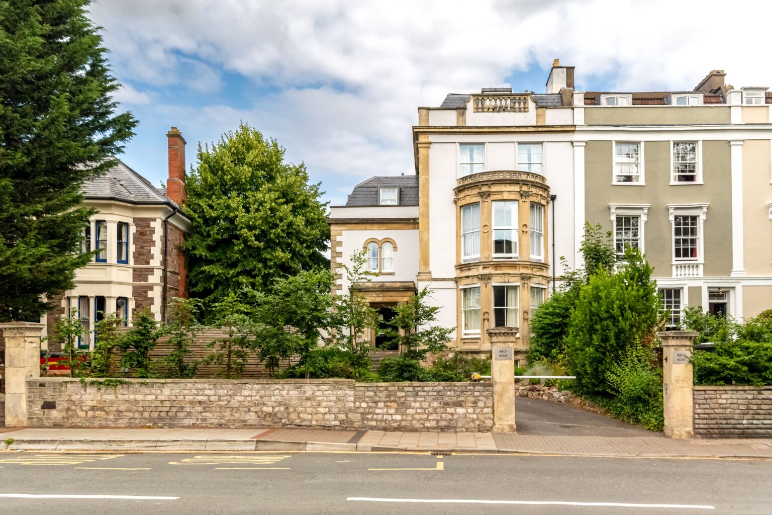
Clifton feels like a village that happens to sit inside a city. Grand terraces line Clifton’s hillside streets. Open grass on the Downs is never far away. The council’s appraisal speaks of a “village-like atmosphere”, with terraces such as Royal York Crescent and the Paragon (Bristol City Council, 2010). More than 1,200 listed buildings were counted across Clifton and Hotwells in 2010, almost a third of Bristol’s total. A listed building is one protected by law for its history or design.
Clifton Village is the place for daily life. Locals use the name for Clifton’s small shopping quarter, centred on Princess Victoria Street, The Mall and Regent Street. The council describes “a buzz of activity and thriving shopping and cafe culture” in the village (Bristol City Council, 2010). Boyce’s Avenue is part of the heart of the village too (Visit Bristol, 2026).
Whiteladies Road is the busier side of Clifton. The council calls it “a principal shopping street” (Bristol City Council, 2026), and it runs from Queens Road up to the Downs. Mature plane trees line the road in parts. Nearby Blackboy Hill keeps “the informal small-town character of the continuous shopping frontages”. Put simply, Blackboy Hill has an unbroken row of small shops.
On Clifton’s western edge, Isambard Kingdom Brunel’s Clifton Suspension Bridge spans the Avon Gorge. The bridge opened in 1864 (Clifton Suspension Bridge Trust, 2026). You can cross 24 hours a day, all year, apart from planned closures (Clifton Suspension Bridge Trust, 2026). Walking or cycling across is free (Clifton Suspension Bridge Trust, 2026). Drivers pay a £1 contactless toll, by card only, though the Trust has proposed raising it to £1.50 (Clifton Suspension Bridge Trust, 2026). A government decision is still needed.
The Downs give Clifton a huge stretch of open grass, right on its northern edge. Altogether, the Downs cover 442 acres (Society of Merchant Venturers, 2026). An Act of Parliament from 1861 keeps this land “for ever hereafter open and unenclosed”. Legally, the Downs must stay unfenced. Football pitches and a playground sit on the Downs (Bristol City Council, 2026). Picture a Sunday on the Downs: you and your flatmates kicking a football, then coffee back in the village.
Clifton’s downsides are parking and traffic, not safety. On-street parking is under pressure in Clifton, which may help explain why car crime stands out. Rush-hour traffic is also “a significant problem on some streets”, in the council’s words (Bristol City Council, 2010). Without a car, you skip the parking hunt. Buses can still get stuck in rush-hour queues, though.
Getting around is easy from Clifton. Clifton Down station, on Whiteladies Road, is run by GWR, the train company (National Rail, 2026). From the station, the University of Bristol’s main campus is a 10 to 15 minute walk (University of Bristol, 2026). Trains from Clifton Down run roughly every 30 minutes Monday to Saturday (Travelwest, 2026). Sundays bring an hourly service.
Buses fill the gaps. The 8 runs “at least every 10 minutes at peak times” (University of Bristol, 2026). For the University of Bristol, the 72 stops on Tyndall Avenue (Travelwest, 2026). Further out, the 72 also reaches the Frenchay campus of the University of the West of England (UWE Bristol). Late at night, the 70 runs 24 hours a day between the city centre and Frenchay (First Bus, 2026). Both the 8 and the 72 changed route on 30 August 2026 (West of England Combined Authority, 2026). Check the current stops before you travel.
Clifton suits a lot of people, but it isn’t your only good option. Redland and Cotham sit right next door. If you’re still comparing neighbourhoods, our guide to where to live in Bristol as a student covers the other options.
Living in Clifton as a student
Three of our homes are in Clifton: Beech House, Redmayne House and Alison Court. The village, the Downs and the university are all close by.
Our other homes sit around the Clifton Triangle and Park Street, including Charlotte’s Rise and 18 Charlotte Street. All are a short walk from the University of Bristol.
Whichever building you choose, the boring stuff is sorted. Your mobile key arrives on your phone before you do. From your start date, it opens the building door and your apartment door at any hour. Lock yourself out, and there’s 24-hour lockout help. The team answers on WhatsApp, WeChat and email, and our office is on Park Street. Can’t visit before you book? We offer virtual tours. Deposits can be paid through WeChat Pay, and there is a Mandarin-speaking team.

For more on how the buildings keep you secure, read our answers to student accommodation security questions. Our Bristol safety guide covers nights out and who to call for help. And our ward-by-ward guide to Bristol’s safest areas compares every district.
How we worked this out
We want you to be able to check every number on this page yourself. Our ward figures come from 62,673 crimes that police.uk logged in Bristol from September 2025 to August 2026 (data.police.uk, 2026). These are our sources, and the periods they cover:
- Ward crime rates, crime mix and map points: police.uk street-level data, September 2025 to August 2026. Rates and the crime mix exclude anti-social behaviour. Map points include it. The three-year change compares this with September 2023 to August 2024.
- The October bike theft figure: three years of police.uk data, month by month, across the whole city.
- Population: ONS mid-2024 estimates (ONS via Nomis, 2025).
- How safe people feel: Bristol City Council’s Quality of Life survey 2024/25, including whether fear of crime affects daily life. Clifton Down’s figures rest on about 100 to 140 replies, like every other ward’s.
- Eight-city comparison: police.uk for the same months, with Census 2021 residents and 2022 ward boundaries.
- Ward boundaries and descriptions: the Local Government Boundary Commission for England, including its June 2026 draft proposals.
Two simple calculations sit behind the figures:
- Crime rate: crimes ÷ residents × 1,000.
- Month index: each month’s crimes set against an average month, where 100 is average. City-wide bike theft scores 145 in October.
Every source has limits. Recorded crime only covers what people report and the police log. Police.uk moves each crime to a nearby point on its map, so locations are approximate (data.police.uk, 2026). It also misses crimes with no exact location. So its total runs a few per cent below the official count. Per-resident rates overstate busy shopping and nightlife areas, where visitors add to crime but not to the population. Our figures use today’s wards, not the proposed new boundaries.
We update these figures every month when police.uk publishes new data. Last updated 2 October 2026.
Frequently asked questions
Is Clifton safe at night?
Yes, very. No other Bristol ward’s residents feel safer after dark than Clifton ward’s. In the council’s 2024/25 survey, 81.9% of Clifton ward residents feel safe after dark, about four in five (Bristol City Council, 2025). Take normal late-night care, as you would anywhere.
Is Clifton Village safe?
Yes, very. Clifton Village, the shopping quarter around Princess Victoria Street and The Mall, sits in Clifton ward. In the year to August 2026, Clifton ward recorded 58.2 crimes per 1,000 residents, less than half Bristol’s rate (data.police.uk, 2026). Compared with Bristol, Clifton ward’s crime leans towards parked cars. Leave nothing on show.
Is Clifton a good place to live?
For many people, yes. Clifton is very safe, with grand terraces, village cafés and the open grass of the Downs close by. By day, 98.6% of Clifton ward residents feel safe, almost everyone (Bristol City Council, 2025). Tight parking and rush-hour traffic on some streets are the trade-offs.
Is Clifton Down safe?
Yes. Clifton Down covers the eastern side of Clifton, including much of Whiteladies Road. Almost everyone in Clifton Down feels safe by day, 97.3% in the council’s survey (Bristol City Council, 2025). Clifton Down’s crime rate sits below Bristol’s (data.police.uk, 2026). Busy shops in Clifton Down see some shoplifting, which targets shops rather than the people who live nearby.
Is Hotwells safe?
Yes, residents feel safe. Hotwells shares a ward with the Harbourside, and 91.3% of the ward’s residents feel safe by day (Bristol City Council, 2025). Recorded crime in the ward is among Bristol’s highest. The ward’s busiest crime spots are on or near a nightclub and the ferry terminal, where most people are visitors (data.police.uk, 2026). Few people live in the ward, so each crime weighs heavily in a per-resident rate. On a night out by the Harbourside, take the usual care.
What is the safest area near the University of Bristol?
Redland, Clifton and Cotham are among the safest areas near the University of Bristol. All three sit in Bristol’s five lowest-crime wards. Of the three, Redland had the lowest rate, at 58.0 crimes per 1,000 residents in the year to August 2026 (data.police.uk, 2026). Redland’s rate is less than half Bristol’s.
Choosing where to live in Bristol
Clifton is a very safe place to live, and three of our homes are right here. Still, a street always feels easier to trust once you’ve seen it. Browse all our Bristol properties to see where each home sits, from Clifton to Park Street. Just message the team or book a viewing, and we’ll arrange a time that suits you. Parents are welcome to get in touch too. We like talking to families.
About the author
Jonathan Brecknell helps run Urban Student, a family of boutique student residences in Bristol managed by Urban Creation. Urban Student has looked after students coming to the University of Bristol for more than 20 years, across 15 properties within walking distance of campus. Jonathan knows Bristol’s neighbourhoods first-hand, including every area our guides cover. He advises students, their families and visitors on everything Bristol, always putting safety and wellbeing first.
Sources
- data.police.uk, Street-level crime data (September 2025 to August 2026), retrieved 2026-09-30, https://data.police.uk/
- data.police.uk, About data.police.uk, retrieved 2026-09-30, https://data.police.uk/about/
- Office for National Statistics via Nomis, Mid-2024 population estimates, retrieved 2026-09-30, https://www.nomisweb.co.uk/
- Bristol City Council, Quality of Life in Bristol (2024/25 survey), retrieved 2026-09-30, https://www.bristol.gov.uk/council-and-mayor/statistics-census-information/quality-of-life-in-bristol
- Local Government Boundary Commission for England, Final recommendations report for Bristol, retrieved 2026-09-30, https://www.lgbce.org.uk/sites/default/files/2023-04/bristol_final_report.pdf
- Local Government Boundary Commission for England, New electoral arrangements for Bristol City Council: Draft Recommendations (June 2026), retrieved 2026-09-30, https://www.lgbce.org.uk/sites/default/files/2026-06/bristol_draft_recommendations_full_report.pdf
- Bristol City Council, Conservation Area 5, Clifton and Hotwells, Character Appraisal and Management Proposals (June 2010), retrieved 2026-09-30, https://www.bristol.gov.uk/files/documents/2927-clifton-and-hotwells-character-appraisal
- Bristol City Council, 12. Whiteladies Road Conservation Area (enhancement statement), retrieved 2026-09-30, https://www.bristol.gov.uk/files/documents/2959-12-whiteladies-road
- Visit Bristol, Explore Clifton, retrieved 2026-09-30, https://visitbristol.co.uk/discover/areas/clifton/
- Clifton Suspension Bridge Trust, History, retrieved 2026-09-30, https://cliftonbridge.org.uk/history/
- Clifton Suspension Bridge Trust, About us, retrieved 2026-09-30, https://cliftonbridge.org.uk/about-us/
- Clifton Suspension Bridge Trust, Crossing the bridge, retrieved 2026-09-30, https://cliftonbridge.org.uk/crossing-the-bridge/
- Clifton Suspension Bridge Trust, Changes to the toll: public consultation, retrieved 2026-09-30, https://cliftonbridge.org.uk/crossing-the-bridge/changes-to-the-toll-public-consultation/
- Society of Merchant Venturers, How the Downs came to be, retrieved 2026-09-30, https://www.merchantventurers.com/our-impact/clifton-and-durdham-downs/how-the-downs-came-to-be/
- Bristol City Council, The Downs, retrieved 2026-09-30, https://www.bristol.gov.uk/residents/museums-parks-sports-and-culture/parks-and-open-spaces/parks-and-estates/the-downs
- University of Bristol, How to get here: maps and travel information, retrieved 2026-09-30, https://www.bristol.ac.uk/maps/how-to-get-here/
- National Rail, Clifton Down Station, retrieved 2026-09-30, https://www.nationalrail.co.uk/stations/clifton-down/
- Travelwest, Severn Beach line, retrieved 2026-09-30, https://travelwest.info/rail/severn-beach-line/
- Travelwest, Bus services to Universities in Bristol and Bath, retrieved 2026-09-30, https://travelwest.info/bus/services-to-university-of-bristol-and-uwe-campuses/
- First Bus, UWE, retrieved 2026-09-30, https://www.firstbus.co.uk/bristol-bath-and-west/your-services/bristol-universities/uwe
- West of England Combined Authority, Major changes to Bristol city centre bus routes at the end of the summer (27 July 2026), retrieved 2026-09-30, https://www.westofengland-ca.gov.uk/news/major-changes-to-bristol-city-centre-bus-routes-at-the-end-of-the-summer/
- police.uk, Crime map, retrieved 2026-10-04, https://www.police.uk/